 USACE Jacksonville conducts site tour, holds public meeting to discuss Everglades Harbor maintenance dredging
A USACE Jacksonville study team conducted a site visit and public meeting in Everglades City, Feb. 1, 2024, in connection with upcoming maintenance dredging of the Everglades Harbor and Channel federal project.
The team toured the harbor and federal channel by boat to assess navigation conditions and scope out advantageous locations for material placement.
In the evening, the team engaged the community at City Hall to present an update them on the status of project planning and to solicit input regarding potential locations for dredged material placement, additional community concerns and possible challenges to the upcoming effort.
View the evening's slide presentation below.
Moving forward, the USACE team will coordinate with the public and responsible state and local agencies, initiate required permitting, conduct a NEPA (National Environmental Policy Act of 1969) analysis and prepare plans and specs for maintenance dredging.
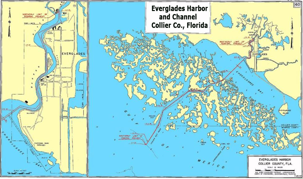
The federal project consists of a channel 8 feet deep and 60 feet wide from that depth in the Gulf of Mexico to mile 1.5 in Barron River, with a turning basin about half an acre in area near its upper end. The total length of the project is about 9.2 miles. It was initially constructed in 1963 and last dredged in 1965.
The upcoming maintenance project is being pursued with $5 million in funding made available under the Disaster Relief Supplemental Appropriations Act of 2022. The project’s non-federal sponsor is the City of Everglades, Florida.
