Bostwick Bomb Target

In 1940, the Navy acquired 640 acres about three miles northwest of Bostwick in Putnam County. The Navy created a 40-acre circular target in the middle of the site, and aircrews from Naval Air Station Jacksonville used it for practice dive bombing. The target became known as both the Bostwick Bomb Target and Putnam Bombing Range, and the Navy used it until 1977 when the Navy determined it no longer needed the site.
The Navy terminated the lease and returned the land to the property owner, but restoration work was required. The Navy searched 70 acres in the center of the site (including the 40 acre target). The Navy personnel dug down as far as two feet and removed any munitions that did not function properly. The land is now owned by two corporations and they use the land for timber.
The U.S. Army Corps of Engineers (USACE) is conducting a Remedial Investigation/Feasibility Study to determine if there are impacts associated with the military’s training, and if so, in what locations and concentrations. USACE will summarize the results of the investigation in a document called a Proposed Plan which will present the alternatives to address what, if anything, remains on the site associated with the former Navy operations. The alternatives can range from no further action being necessary, to educating the public about the site, to remedial action. When the Proposed Plan is ready, USACE will present it at a public meeting, and the public will have at least 30 days to review and submit comments on the plan.
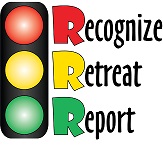
Always use caution when you are on a Formerly Used Defense Site and remember and follow the 3Rs of Explosive Safety: Recognize, Retreat, Report.

RECOGNIZE - The object you found could be dangerous.
RETREAT - Leave the area without touching or moving the object.
REPORT - Call 911 immediately.