May 2024
FACT SHEET
Nassau County, FL
Construction (C)
Congressional District: 4
1. DESCRIPTION
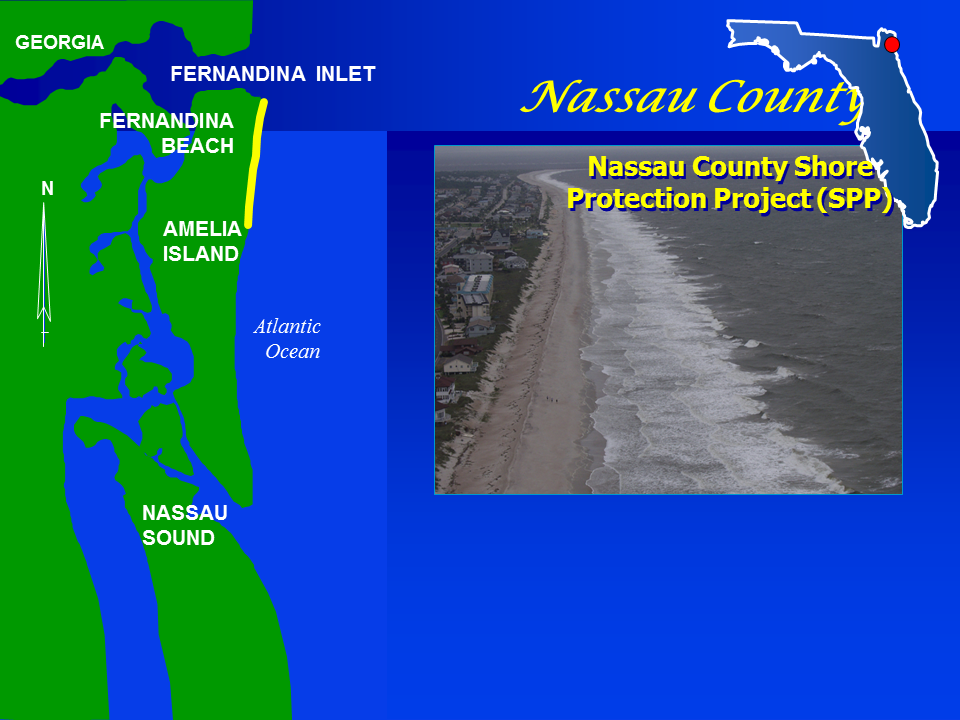
Nassau County is the northernmost county on the east coast of Florida. Amelia Island forms the eastern border, stretching 13 miles south from the St. Mary’s River to the Nassau River. The Water Resources Development Act of 1988 authorized the Nassau County, Florida Shore Protection Project. The authorized project area is located on the Atlantic shorefront of Amelia Island in Nassau County. The project provides for the initial fill for 3.6 miles of shoreline and periodic nourishment along 4.3 miles as needed. The project cost share reflects Section 111 cost mitigation for downdraft impacts of the federal navigation project, Fernandina Harbor.
2. FUNDING
| Estimated Total Cost |
$238,600,000 |
| Estimated Federal Cost |
$188,300,000 |
a. Regular Civil Works Funds:
| Allocation thru FY23 |
$17,584,000 |
| Allocation for FY24 |
$0 |
| President's Budget FY25 |
$8,785,000 |
b. P.L. 115-123: Bi-Partisan Budget Act of 2018, Supplemental::
| Resiliency |
|
| Allocation thru FY23 |
$100,000 |
c. P.L. 117-58: Bi-Partisan Infrastructure Law:
| Total Work Plan |
$5,113,000 |
| Allocation thru FY23 |
$5,113,000 |
| Allocation for FY24 |
$0 |
d. P.L. 117-328A: Disaster Relief Supplemental Appropriations Act:
| Current Working Estimate |
$18,329,000 |
| Allocation thru FY23 |
$941,100 |
3. SPONSOR
City of Fernandina Beach
Fernandina Beach, Florida 32034
4. STATUS
The next renourishment is scheduled for FY25 and will be fully funded with DRSSA-23 funding in response to damages to the project sustained from Hurricane Nicole.
In response to the SAJ real estate request for easements to construct dunes in accordance with the Dune Resiliency EDR, the NFS passed a resolution requesting the Dune Resiliency EDR be rescinded. It will be very costly and time consuming to attain the easements required to construct the dunes; furthermore, it may be impossible to attain some easements due to litigation when the original berm easements were attained. An MFR has been approved which rescinds the Dune Resiliency EDR returning the project to its original design which only includes a berm. PM is working with OC to prepare a PCA amendment to remove the Dune Resiliency EDR from the project scope. For construction of a berm only, SAJ-RE reviewed all existing real estate easements and found that all easements are perpetual easements except for six real estate easements that are 50-year easements as a result of a court order. SAJ-RE has prepared a waiver for the six 50-year easements. All project easements include a contour line as the landward limit.
A NEPA update (Supplemental EA) will be required to conduct beach placement outside of the previous environmental window (prior to SARBO 2020). Beach placement must occur outside of the previous environmental windows to avoid conflicts with the NSB Kings Bay Entrance Channel Maintenance Dredging.
Design is scheduled to kickoff in May 2024; if the PCA amendment to remove the Dune Resiliency EDR is not executed by May 2024 and the NEPA not updated by BCOES Certification, the procurement schedule may be delayed.
Current procurement schedule:
- 1 May 24 – Design Kickoff
- 15 May 24 – PCA Amendment Executed
- 12 Dec 24 – BCOES Certification
- 15 Apr 25 – Award Contract
- 1 Nov 24 – FONSI Signed (e.g. NEPA Update)
- 14 Nov 25 – Complete Renourishment
Once the FY25 renourishment is completed, SAJ will continue with the current Regional Sediment Management (RSM) Strategy for the project, the project will be partially renourished as a disposal area for beach quality material dredged from the Kings Bay Entrance Channel Maintenance Dredging Project.
