March 2018
FACT SHEET
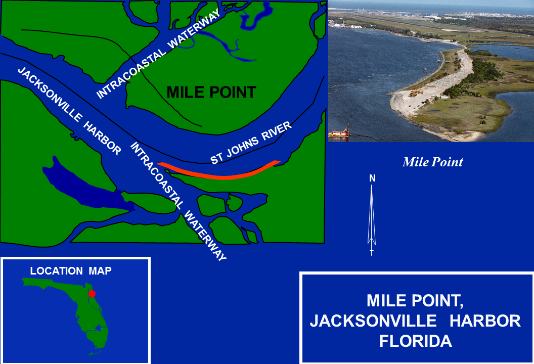
Jacksonville Harbor – Mile Point, FL
Construction (C)
Congressional Districts: 3, 4, 5
1. DESCRIPTION
Mile Point consists of approximately 5,000 feet of shoreline located along the north shore of the St. Johns River and east of the Intracoastal Waterway (IWW). Great Marsh Island and the Mile Point Training Wall divide Chicopit Bay. The confluence of the St. Johns River with the IWW is known as Mile Point, an area that experiences difficult crosscurrents on the ebb tide. Due to these crosscurrents there is navigational restriction on the ebb tide that affects all vessels that have a transit draft greater than 33 feet inbound and 36 feet outbound, inhibiting the free movement of vessel traffic.
2. FUNDING
| Estimated Total Cost |
$52,300,000 |
| Estimated Federal Cost |
$39,200,000 |
| Allocation thru FY17 |
$936,000 |
| Allocation for FY18 |
$0 |
| President’s Budget FY19 |
$0 |
3. SPONSOR
Jacksonville Port Authority
2831 Talleyrand Avenue
Jacksonville, FL 32206-3496
4. STATUS
The construction of Phase 1 was completed in September 2017. Phase 2 of the project which includes oyster bed and seagrass planting will kick off in July 2018.