May 2023
FACT SHEET
San Juan Metro Area PR CSRM Study
Investigations (I)
Congressional District: Puerto Rico
1. DESCRIPTION
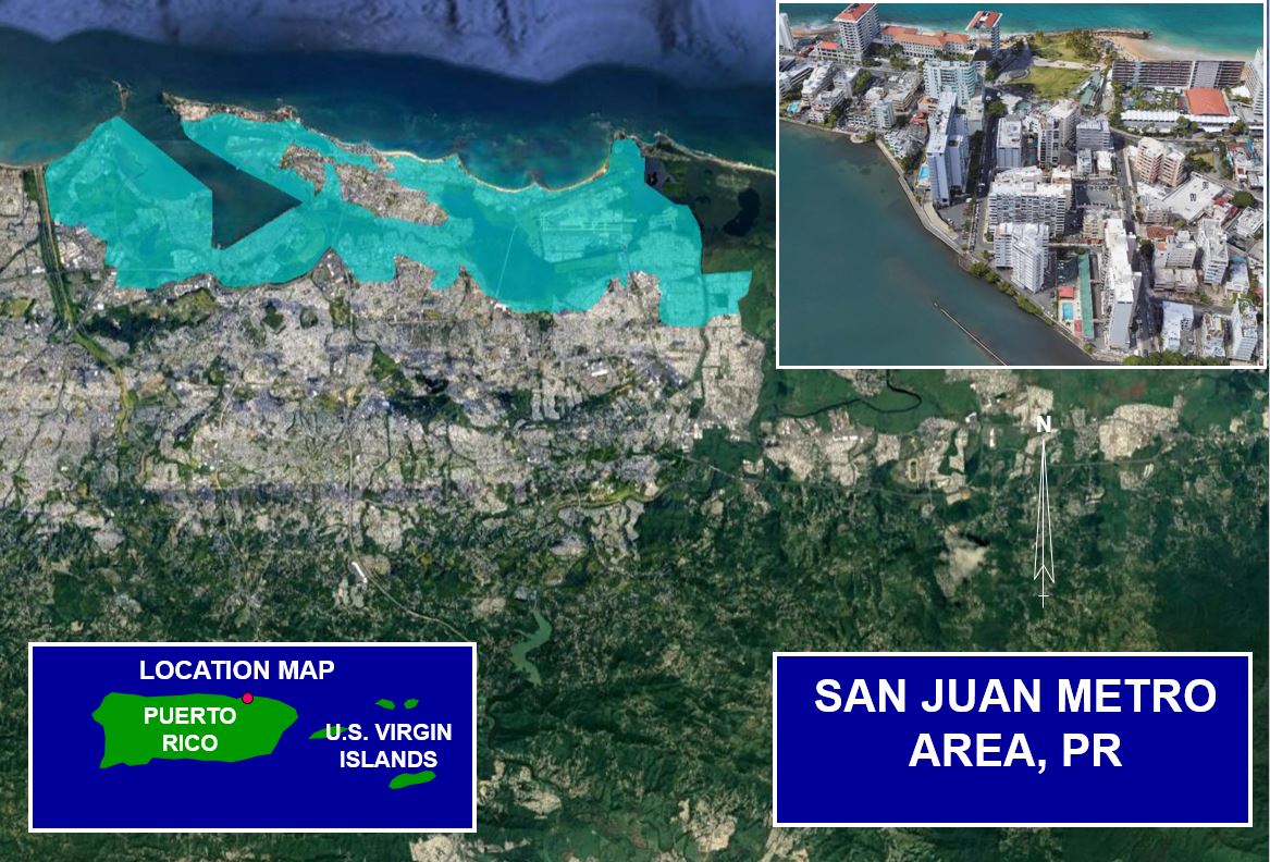
The majority of Puerto Rico’s population lives within the San Juan Metro area and the vast majority of critical infrastructure investments such as hospitals, schools, power plants, government buildings, and roads are located near the coastally influenced bays, lagoons and canals in the San Juan Metro area. The study area has suffered extensive damage from multiple tropical and extratropical storms to include Hurricane Hugo (1989), Hurricane Luis (1995), Hurricane George (1998), and Nor’easter (2008), with the most recent being Hurricanes Irma and Maria (2017) and Nor’easter (2018). Hurricanes on average hit Puerto Rico about once every three years and strong nor’easters every 10 years.
The primary objectives of the project are to reduce the risk of damages from coastal flooding and wave attacks during hurricanes and storms and to increase community resilience from coastal storms and sea levels rising in the entire San Juan Metro Area, allowing the communities to return to normal life sooner, with less economic impacts after an event. The study spans across the 4 municipalities of Toa Baja, Cataño, Guaynabo, and San Juan.
The study area has approximately 20,000 assets, with a combined estimated value of $3.4 billion. Coastal flooding from storm surge, tide and wave contributions causes major damages to these assets. The Recommended Plan consists of a collection of key structural and natural features in specific locations of low elevation where the highest risk of coastal flooding occurs. The project will provide important and extremely effective coastal flooding damage reduction to the homes and businesses within the San Juan Metro Area. It includes construction of a discharge structure, levees, breakwaters, seawalls, and floodwalls in Toa Baja, Cataño, and Guaynabo. The Recommended Plan also includes an elevated living shoreline along the northern portion of the Condado Lagoon. Inland hydrology features, such as pump stations and culverts, will complement the project by allowing rainfall runoff through the newly constructed coastal features. Other key aspects of the plan include environmental mitigation, habitat creation and recreation opportunities on the levees and elevated living shoreline, which can be used by the community for outdoor activities. The Recommended Plan reasonably maximizes net benefits to contribute to the National Economic Development (NED) Plan and is consistent with protecting the nation's environment.
2. FUNDING
a. Regular Civil Works funds:
| Allocation for FY23 |
$0 |
| President’s Budget FY24 |
$0 |
b. P.L. 115-123: Bi-Partisan Budget Act of 2018, Supplemental:
| Current Working Estimate |
$2,800,000 |
| Allocation thru FY22 |
$2,800,000 |
| Allocation for FY23 |
$0 |
3. SPONSOR
Puerto Rico Department of Natural and Environmental Resources (DNER)
P.O. Box 366147
San Juan, Puerto Rico 00936
4. STATUS
The Chief’s Report was completed in September 2021. The project was authorized in Public Law No: 117-263, Water Resources Development Act (WRDA) 2022. Capability is being expressed for authorized Pre-Construction, Engineering and Design (PED) for the first useful increment of the authorized project in the current open budget cycle.
