May 2023
FACT SHEET
Rio Nigua at Salinas PR (I)
Investigation (I)
Congressional Districts: Puerto Rico
1. DESCRIPTION
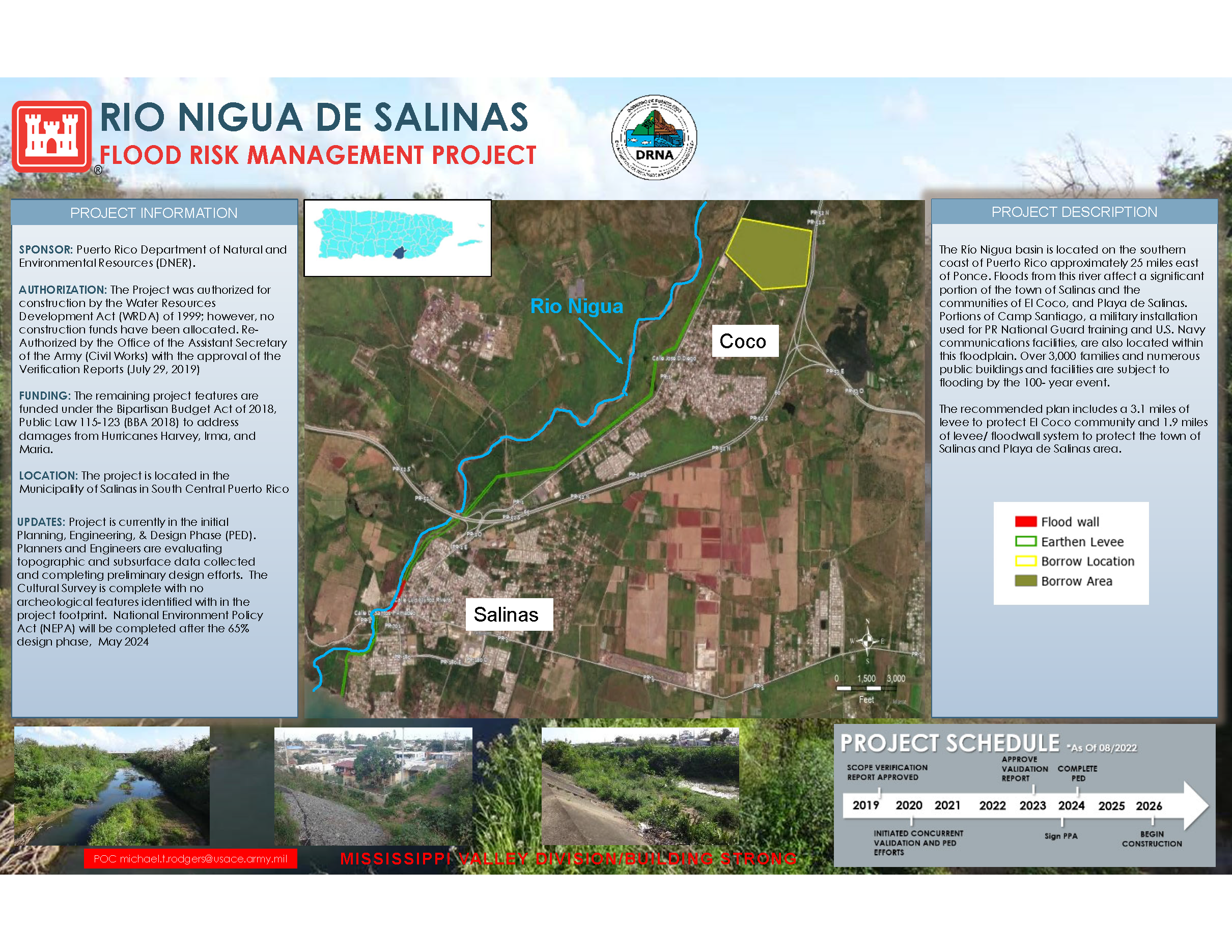
The Río Nigua basin is located on the southern coast of Puerto Rico approximately 25 miles east of Ponce. Floods from this river affect a significant portion of the town of Salinas and the communities of El Coco and Playa de Salinas. Portions of Camp Santiago, a military installation used for PR National Guard training and U.S. Navy communications facilities, are also located within this floodplain. Over 3,000 families and numerous public buildings and facilities are subject to flooding by the 100- year event. The recommended plan includes 3.1 miles of levee to protect the El Coco community and 1.9 miles of a levee/floodwall system to protect the town of Salinas and the Playa de Salinas area.
2. FUNDING
| Estimated Total Cost |
$1,500,000 |
| Estimated Federal Cost |
$1,100,000 |
a. Regular Appropriations:
| Allocation thru FY22 |
$82,000 |
| Allocation for FY23 |
$0 |
| President’s Budget FY24 |
$0 |
b. P.L. 115-123: Bipartisan Budget Act of 2018, Supplemental:
| Current Working Estimate |
$0 |
| Allocation thru FY22 |
$0 |
| Allocation for FY23 |
$0 |
3. SPONSOR
Puerto Rico Department of Natural and Environmental Resources (DNER)
P.O. Box 9066600, Puerta de Tierra
San Juan, Puerto Rico 00906-6600
4. STATUS
The team is finalizing the validation report and the 35% design. The project scope, schedule, and budget will be revised in 3rd Quarter FY23 once finalized. The project has been authorized for construction under Water Resources Development Act (WRDA) 2022.
