March 2019
FACT SHEET
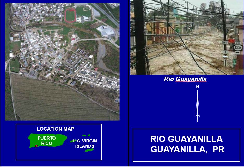
Rio Guanajibo PR (I)
Investigation (I)
Congressional Districts: Puerto Rico
1. DESCRIPTION
The Rio Guayanilla study area comprises the Guayanilla coastal flood plain located about 16 kilometers west of the city of Ponce. Within the flood plain lies the Town of Guayanilla with an urban population of 4,000 as per 2010 Census, the Playa de Guayanilla sector and other rural communities. A serious flood problem exists as the river passes directly through the middle of Town. Damages associated with flooding have been reported by the Municipality ten times in the last twenty-five years. In addition to property damages, a serious risk exists to the lives and wellbeing of those residing within the flood plain. Frequent flooding seriously impedes the socio-economic development of the community. Previous studies have evaluated possible flood control measures that would protect the northern, southern and central sections of the Town of Guayanilla, Playa de Guayanilla, as well as the Piedras Blancas sector. These communities would be protected against a 100-year flood event. The Department of Natural and Environmental Resources has completed a project in the lower portions of the flood area in 2006.
2. FUNDING
a. P.L. 115-123: Bi-Partisan Budget Act of 2018, Supplemental:
| Current Working Estimate |
$3,000,000 |
| Allocation thru FY18 |
$0 |
| Allocation for FY19 |
$0 |
3. SPONSOR
Puerto Rico Department of Natural and Environmental Resources
P.O. Box 9066600
Puerta de Tierra
San Juan, Puerto Rico 00906-6600
4. STATUS
The study was brokered to the Great Lakes and Ohio River Division (LRD). The Chicago District Project Delivery Team (PDT) held the Alternatives Milestone Meeting (AMM) on 18 Dec 2018. The next major milestone is the Tentatively Selected Plan scheduled for 24 Sep 2019. The Chief of Engineers’ report is scheduled for 23 Sep 2021. The study will look into structural measures such as levees/floodwalls, bridge modifications, channel bank restorations, diversion of the existing channel, grade control, and vegetation removal.