June 2021
FACT SHEET
Fort Myers Beach, FL (O&M)
Operations and Maintenance
Congressional District: 19
1. DESCRIPTION
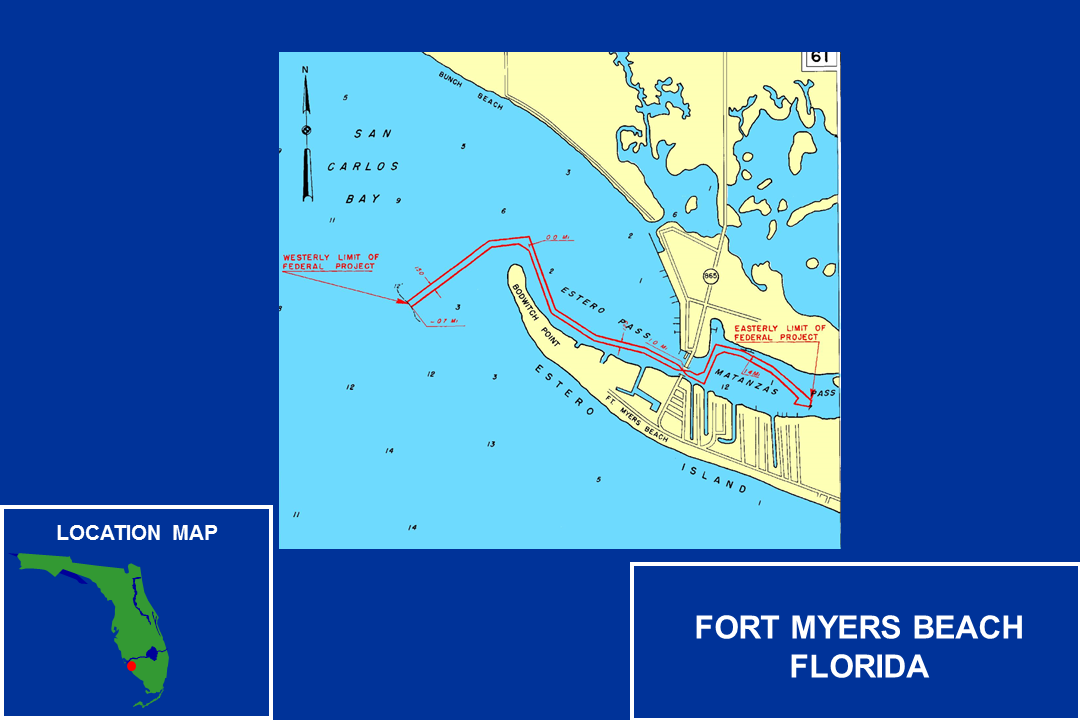
A channel 12 feet deep and 150 feet wide in San Carlos Bay until the end east side of Bowditch Point, thence 12 feet deep and 125 feet wide from that depth and location in San Carlos Bay into Estero Pass at the intersection of San Carlos Blvd Bridge, thence 11 feet deep and 125 feet wide in Matanzas Pass to the upper shrimp terminals terminating at a turning basin located approximately 1000 feet away. Length of project is about 2.5 miles.
2. FUNDING
a. Regular Civil Works Funds:
| Allocation for FY21 |
$0 |
| President’s Budget FY22 |
$0 |
b. P.L. 115-123: Bi-Partisan Budget Act of 2018, Supplemental:
| Current Working Estimate |
$400,000 |
| Allocation thru FY20 |
$400,000 |
| Allocation for FY21 |
$0 |
c. P.L. 116-20: Additional Supplemental Appropriations for Disaster Relief Act, 2019:
| Current Working Estimate |
$4,156,000 |
| President’s Budget FY20 |
$4,156,000 |
3. SPONSOR
Lee County Natural Resources Division
1500 Monroe Street
Fort Myers, FL 33901
4. STATUS
Fort Myers Inlet (Matanzas Pass) was recently dredged between August and October 2020. Prolonged shoaling from Bowditch Point had encroached across the federal channel causing the navigable waterway to be pushed more northerly. The federal channel was re-established along the north side of Bowditch Point after 151,252 cubic yards of material was removed from the channel and placed in the nearshore disposal area located south of the inlet. Only a few months following the dredging event, shoaling was reported by the US Coast Guard to be occurring off Bowditch Point. The Corps is working with the US Coast Guard to perform surveys of the inlet on a recurring basis so aids to navigation can be adjusted. The project delivery team is working on appropriations to evaluate realigning the channel away from Bowditch Point to alleviate the chronic shoaling issues.
